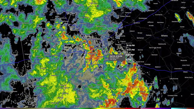
desktop computer weather radar app shows thunderstorms approaching atlanta, georgia in the early summer of 2021. - meteorology map stock videos & royalty-free footage00:21Desktop computer weather radar app shows thunderstorms approaching Atlanta, Georgia in the early summer of 2021.
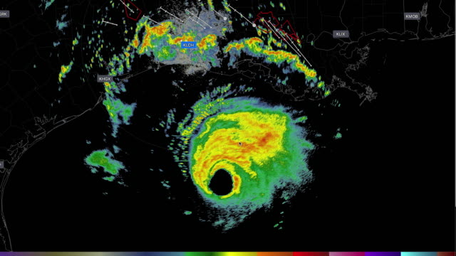
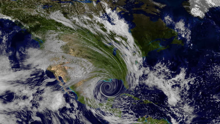
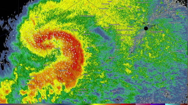
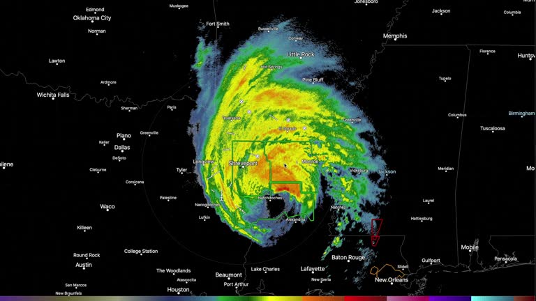
desktop computer weather radar app shows the hurricane laura invading america on the august 26, 2020, and caused tornado warnings in louisiana - meteorology map stock videos & royalty-free footage00:12Desktop computer weather radar app shows the hurricane Laura invading America on the August 26, 2020, and caused tornado warnings in Louisiana
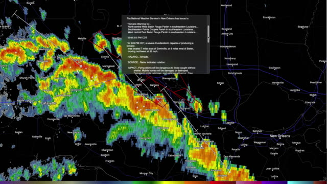
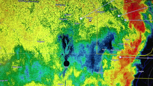
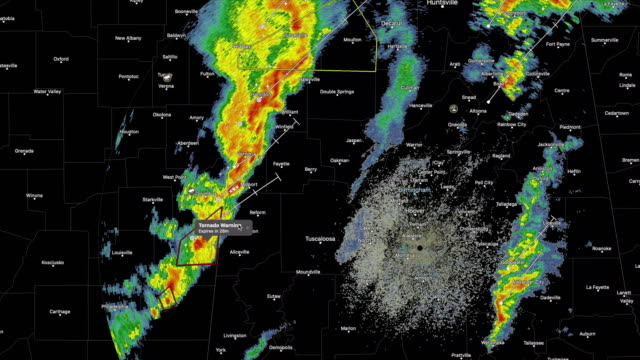
weather radar shows tornado warning in the southeast of america - meteorology map stock videos & royalty-free footage00:16Weather radar shows tornado warning in the southeast of America
weather map animation - southern and central europe - meteorology map stock videos & royalty-free footage00:28Weather map animation - southern and central Europe
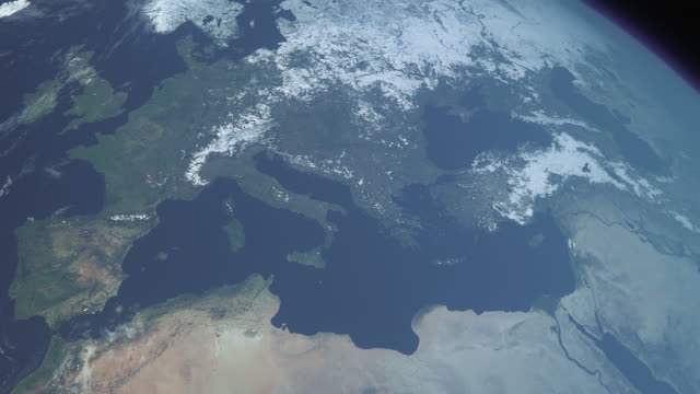
cgi, view from space, zi, planet earth, hurricane on river thames - meteorology map stock videos & royalty-free footage00:46CGI, VIEW FROM SPACE, ZI, Planet Earth, hurricane on river Thames
usa weather map animation - meteorology map stock videos & royalty-free footage00:28USA weather map animation
close-ups of weather chart and weather data in uk met office; 1990 - meteorology map stock videos & royalty-free footage00:06Close-ups of weather chart and weather data in UK Met Office; 1990
two weather radars on the path stopped working. desktop computer weather radar app shows the hurricane laura moving north the second day after landed in america on the august 26, 2020. - meteorology map stock videos & royalty-free footage00:16Two weather radars on the path stopped working. Desktop computer weather radar app shows the hurricane Laura moving north the second day after landed in America on the August 26, 2020.
desktop computer weather radar app shows the hurricane laura invading america on the august 26, 2020, and caused tornado warnings in louisiana - meteorology map stock videos & royalty-free footage00:29Desktop computer weather radar app shows the hurricane Laura invading America on the August 26, 2020, and caused tornado warnings in Louisiana
earth after 70-metre sea level rise - meteorology map stock videos & royalty-free footage00:24Earth after 70-metre sea level rise
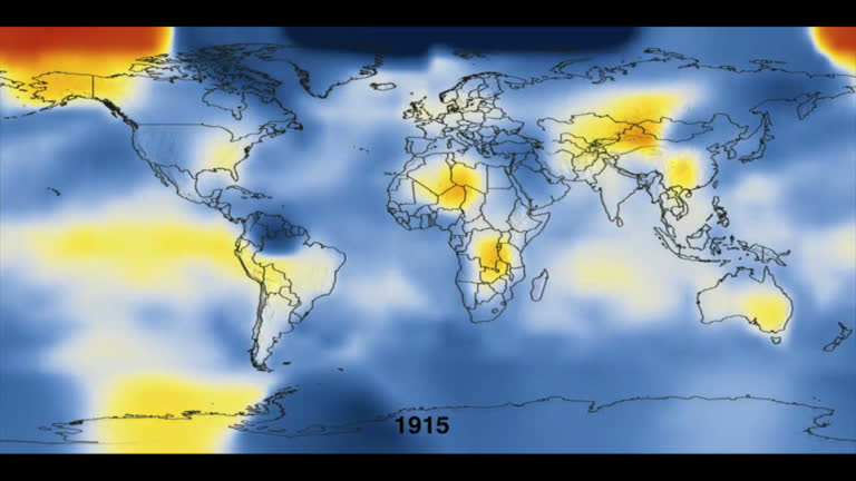
global temperature differences from 1880 to 2007. - meteorology map stock videos & royalty-free footage00:16Global temperature differences from 1880 to 2007.
weather radar shows thunderstorm moving in the southeast of america - meteorology map stock videos & royalty-free footage00:12Weather radar shows thunderstorm moving in the southeast of America ( NO AUDIO )
weather forecast in san francisco - meteorology map stock videos & royalty-free footage00:20Weather Forecast in San Francisco
hurricane. with flares. - meteorology map stock videos & royalty-free footage00:17Hurricane. With flares.
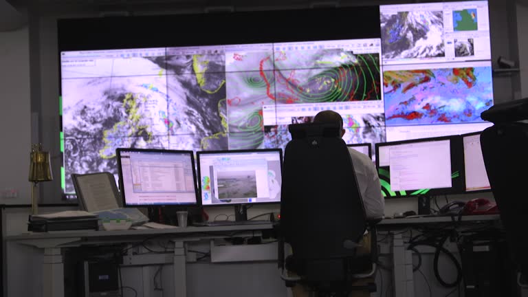
interior of met office and digital weather maps used to predict the weather, in their control centre - meteorology map stock videos & royalty-free footage00:08Interior Met Office weather control centre
weather map animation - north-eastern usa - meteorology map stock videos & royalty-free footage00:28Weather map animation - north-eastern USA
desktop computer weather radar shows severe thunderstorm warnings in the middle of america on april 08th, 2020 - meteorology map stock videos & royalty-free footage00:18Desktop computer weather radar shows severe thunderstorm warnings in the Middle of America on April 08th, 2020
weather radar shows thunderstorm in the central south of usa on desktop computer screen - meteorology map stock videos & royalty-free footage00:15Weather radar shows thunderstorm in the central south of USA on desktop computer screen
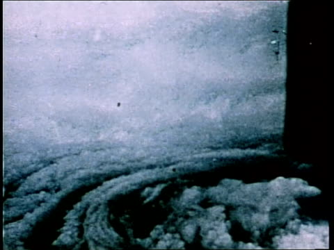
model of ice sheet on earth. nasa public domain imagery - meteorology map stock videos & royalty-free footage00:12Model of ice sheet on Earth. Nasa Public Domain Imagery
mechanism of seasonal rain front - meteorology map stock videos & royalty-free footage00:14Mechanism of seasonal rain front
weather radar shows tornado warning in the southeast of america - meteorology map stock videos & royalty-free footage00:13Weather radar shows tornado warning in the southeast of America
soviet meteor weather satellite helps predict weather patterns - meteorology map stock videos & royalty-free footage00:59Soviet Meteor weather satellite helps predict weather patterns
what makes weather? (2nd edition) - part 22 of 24. vivid satellite footage, helpful animation, and live action and time-lapse photography show the working forces that produce weather. the film examines the movement of winds and air masses caused by the un - meteorology map stock videos & royalty-free footage00:35What Makes Weather? (2nd edition) - part 22 of 24. Vivid satellite footage, helpful animation, and live action and time-lapse photography show the working forces that produce weather. The film examines the movement of winds and air masses caused by the un
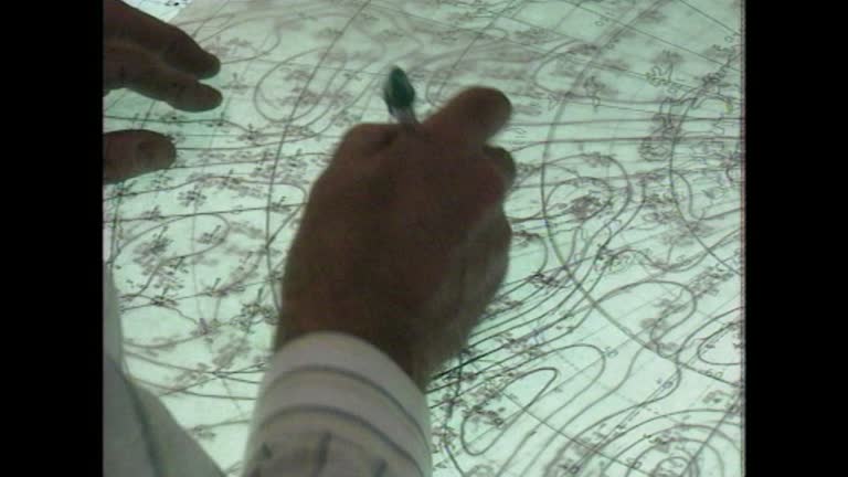
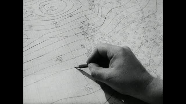
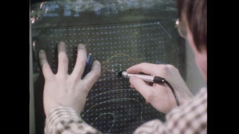
cu human hand draws isobar onto weather chart; 1953 - meteorology map stock videos & royalty-free footage00:10CU human hand draws isobar onto weather chart; 1953
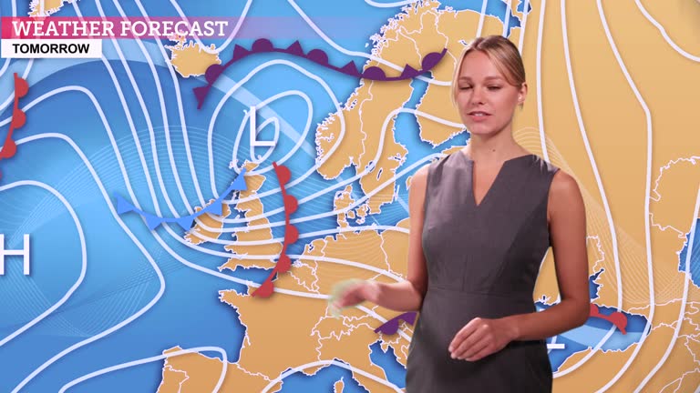
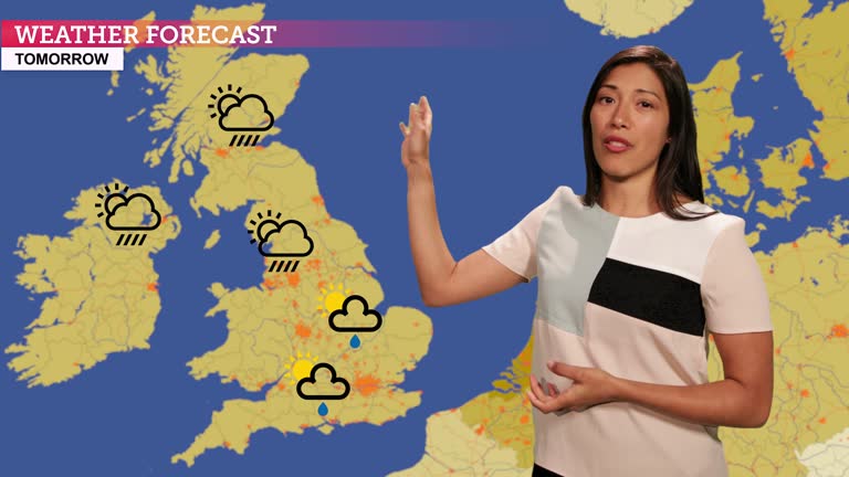
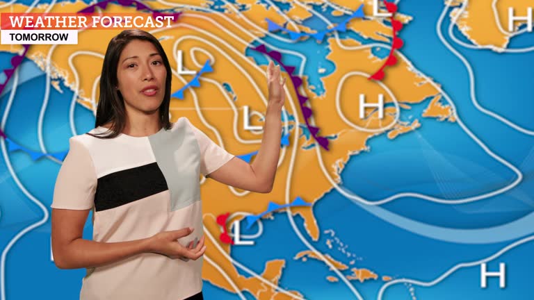
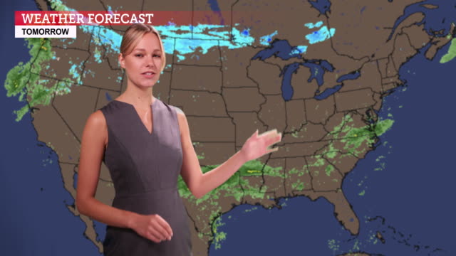
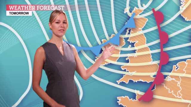
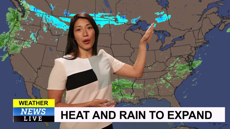
weather forecast in a green screen studio - meteorology map stock videos & royalty-free footage00:15Weather forecast in a green screen studio
has played an important role in giving information about the meteorological phenomenon that has pounded the u.s.a. elements of this image furnished... - meteorology map stock videos & royalty-free footage01:36United States: Weather Map of Hurricane Harvey, point of view from space
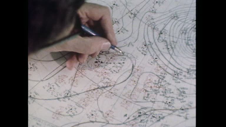
zoom in over a man's shoulder to a weather map being plotted and drawn in the uk met office; 1980. - meteorology map stock videos & royalty-free footage00:11Zoom in weather map being plotted in UK Met Office, UK; 1960
scientist devastated by earth's climat changes. visualisation of co2 distribution - meteorology map stock videos & royalty-free footage00:17Scientist devastated by Earth's climat changes. Visualisation of CO2 distribution
desktop computer weather radar app shows the hurricane laura moving north the second day after landed in america on the august 26, 2020. - meteorology map stock videos & royalty-free footage00:16Desktop computer weather radar app shows the hurricane Laura moving north the second day after landed in America on the August 26, 2020.
weather radar shows thunderstorm in the central south of usa on desktop computer screen. - meteorology map stock videos & royalty-free footage00:25Thunderstorm
earth winds directions. nasa public domain imagery - meteorology map stock videos & royalty-free footage00:21Earth winds directions. Nasa Public Domain Imagery
soviet weather agency uses satellite info to create forecast - meteorology map stock videos & royalty-free footage01:12Soviet weather agency uses satellite info to create forecast
weather forecast in a green screen studio - meteorology map stock videos & royalty-free footage00:16Weather forecast in a green screen studio
wide shot weather satellite views of cloud cover and data displays - meteorology map stock videos & royalty-free footage00:14Wide shot weather satellite views of cloud cover and data displays
a computer animation demonstrates how a weather depression over the atlantic ocean creates a high tide that funnels up the thames river and overflows its banks. - meteorology map stock videos & royalty-free footage00:39A computer animation demonstrates how a weather depression over the Atlantic Ocean creates a high tide that funnels up the Thames River and overflows its banks.
sequence showing a medium shot of a man collecting a print out of weather data and a close-up of his hands plotting it onto a large weather map in... - meteorology map stock videos & royalty-free footage00:16Man plots weather data onto large map in UK Met Office; 1980
earth after 70-metre sea level rise - meteorology map stock videos & royalty-free footage00:32Earth after 70-metre sea level rise
pilgrims sail for america - meteorology map stock videos & royalty-free footage00:25Pilgrims sail for America
montage forecaster reviewing and preparing the weather report / england, united kingdom - meteorology map stock videos & royalty-free footage01:04MONTAGE Forecaster reviewing and preparing the weather report / England, United Kingdom
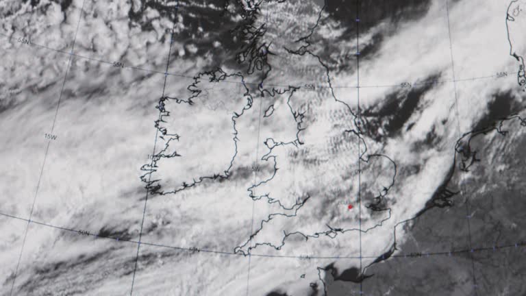
weather map showing meteorological data, met office, exeter, england - meteorology map stock videos & royalty-free footage00:10Weather map showing meteorological data, Met Office, Exeter, England
4k code background - information concept - meteorology map stock videos & royalty-free footage00:294k code background - information concept
panning shot following a man collecting and carrying a weather map to a desk in the uk met office; 1980. - meteorology map stock videos & royalty-free footage00:11Pan man carries weather map through Met Office, UK; 1980
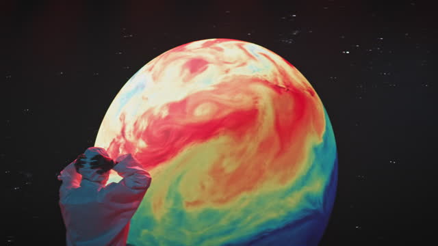
planet weather cycling loopable 3d animation - meteorology map stock videos & royalty-free footage00:59Planet Weather Cycling Loopable 3D Animation
meteorologists work with radar and computers to track a hurricane. - meteorology map stock videos & royalty-free footage00:41Meteorologists work with radar and computers to track a hurricane.
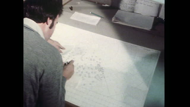
met office worker draws on a meteorological map. 1961. - meteorology map stock videos & royalty-free footage00:08A Met Office worker draws on a meteorological map. 1961.
close-up of weather data printing out on an old printer, pulling out to show women examining spools of paper print outs from a bank of large,... - meteorology map stock videos & royalty-free footage00:30Weather data being printed in the UK Met Office; 1980
desktop computer weather radar shows severe thunderstorm warnings in the middle of america on april 08th, 2020 - meteorology map stock videos & royalty-free footage00:19Desktop computer weather radar shows severe thunderstorm warnings in the Middle of America on April 08th, 2020
weather forecast in a green screen studio - meteorology map stock videos & royalty-free footage00:16Weather forecast in a green screen studio
weather forecast in a green screen studio - meteorology map stock videos & royalty-free footage00:17Weather forecast in a green screen studio
weather forecast in a green screen studio - meteorology map stock videos & royalty-free footage00:18Weather forecast in a green screen studio
weather map showing meteorological data, met office, exeter, england - meteorology map stock videos & royalty-free footage00:07Weather map showing meteorological data, Met Office, Exeter, England
weather map showing meteorological data, met office, exeter, england - meteorology map stock videos & royalty-free footage00:12Weather map showing meteorological data, Met Office, Exeter, England
a satellite weather map tracks the path of a tornado moving across kansas and missouri - meteorology map stock videos & royalty-free footage00:15A satellite weather map tracks the path of a tornado moving across Kansas and Missouri
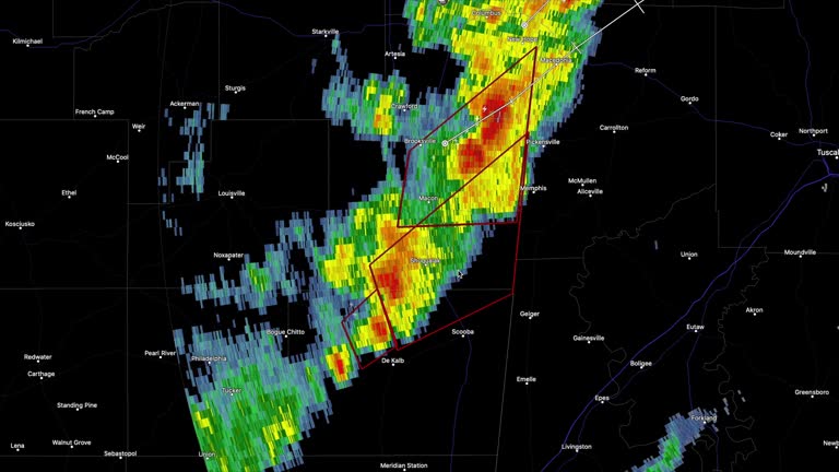
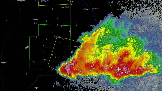
desktop computer weather radar app shows thunderstorms and tornado warning in jackson, mississippi - meteorology map stock videos & royalty-free footage00:34Desktop Computer Weather Radar App Shows Thunderstorms And Tornado Warning In Jackson, Mississippi
high angle dr. james kimball, noted weatherman, seated at desk studying weather map / kimball, pan down to his hand with pen moving on map / over the... - meteorology map stock videos & royalty-free footage01:27Noted meteorologist Dr. James Kimball studies a weather map
sequence showing a panning shot of a man carrying a plastic weather map overlay and a close-up of the plastic map being placed over a computer screen... - meteorology map stock videos & royalty-free footage00:29Man plots weather data onto computer map in UK Met Office; 1980
earth science: exploring planet earth - part 28 of 35. earth science embraces broad areas of study. since ancient times, humans have tried to discover the secrets of earth. we have studied the motions of celestial bodies, made observations on volcanic act - meteorology map stock videos & royalty-free footage00:30Earth Science: Exploring Planet Earth - part 28 of 35. Earth science embraces broad areas of study. Since ancient times, humans have tried to discover the secrets of Earth. We have studied the motions of celestial bodies, made observations on volcanic act
the northeast: gateway for a nation - part 12 of 18. illustrates the effect that a major part of us industrial activity - the shipment of goods - has on industry itself and on the people involved. the mass of american goods that moves through the eastern - meteorology map stock videos & royalty-free footage00:33The Northeast: Gateway for a Nation - part 12 of 18. Illustrates the effect that a major part of US industrial activity - the shipment of goods - has on industry itself and on the people involved. The mass of American goods that moves through the Eastern
the northeast: gateway for a nation - part 11 of 18. illustrates the effect that a major part of us industrial activity - the shipment of goods - has on industry itself and on the people involved. the mass of american goods that moves through the eastern - meteorology map stock videos & royalty-free footage00:33The Northeast: Gateway for a Nation - part 11 of 18. Illustrates the effect that a major part of US industrial activity - the shipment of goods - has on industry itself and on the people involved. The mass of American goods that moves through the Eastern
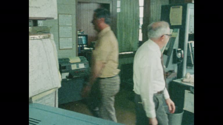
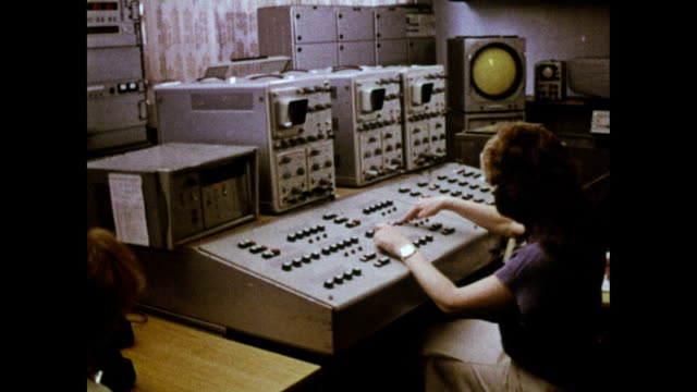
various shots of large computer at the met office used to predict weather conditions and changes in climate - meteorology map stock videos & royalty-free footage00:17Met Office computer
weather forecast in a green screen studio - meteorology map stock videos & royalty-free footage00:16Weather forecast in a green screen studio
newscaster reading the breaking news - meteorology map stock videos & royalty-free footage00:25Newscaster Reading The Breaking News
montage forecaster reporting storm is passing / london, england, united kingdom - meteorology map stock videos & royalty-free footage01:06MONTAGE Forecaster reporting storm is passing / London, England, United Kingdom
1930s zoom in meteorological globe to "torrid zone" around equator - meteorology map stock videos & royalty-free footage00:081930s zoom in meteorological globe to "Torrid Zone" around equator
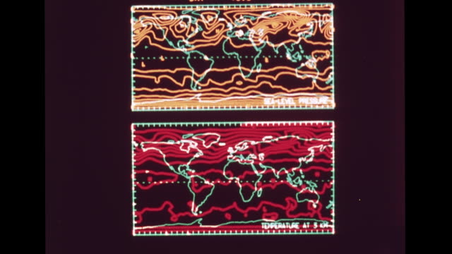
monitor displaying theoretical computer generated electronic temperature & sea-level pressure weather maps. 1960s, forecasting, meteorology,... - meteorology map stock videos & royalty-free footage00:161968: NATIONAL METEOROLOGICAL CENTER: HD: VS Monitor displaying theoretical computer generated electronic temperature & sea-level pressure weather maps. 1960s, forecasting, meteorology, technology, science, research.
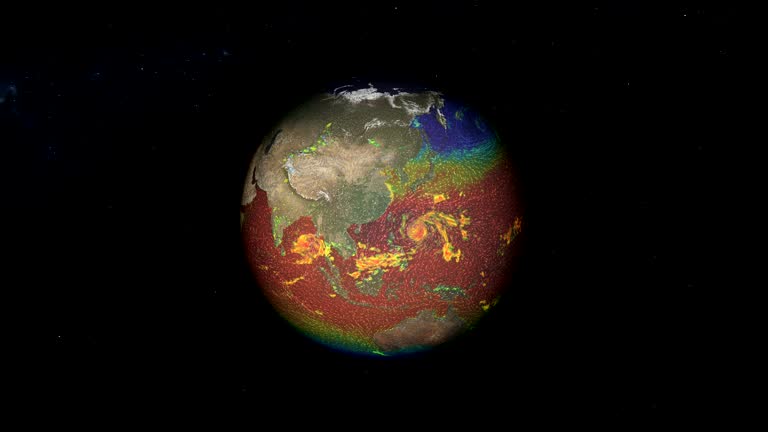
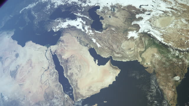
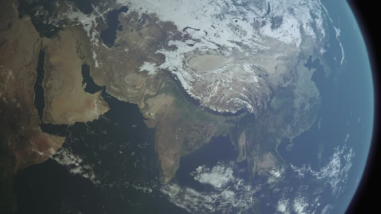
weather map of precipitation of planet earth globe in space - meteorology map stock videos & royalty-free footage00:26Weather map of precipitation of planet Earth globe in space
4k timelapse milky way night sky at doi chang mountain. - meteorology map stock videos & royalty-free footage00:094K Timelapse Milky way Night Sky at Doi Chang Mountain.